
Unseen Bangladesh Map – Create Your Travel Map
Unseen Bangladesh Map lets you mark visited districts, choose a color theme and download your Bangladesh travel map as PNG, JPG or PDF.
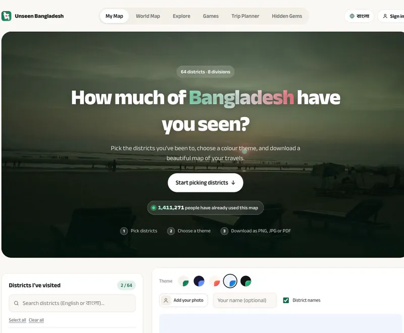
Open the original Unseen Bangladesh map maker to mark and export your visited districts.
Open Travel MapAfter a short countdown, the original map opens. Public map selection can be tried without signing in.

















A Personal Record of Your Bangladesh Travels
- Category
- Mobile Tools
- Platform
- Web browser
- Mode
- Personal travel-map creator
- Developer
- Sabbir Hossien
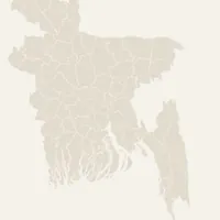
Unseen Bangladesh Map is a visual record of which of the country's 64 districts you have visited. You can make the same selection two ways — find a name in the division-based list, or tap the region on the map. You build the record yourself; there is no route to enter or quiz to pass. The country outline becomes a snapshot of your travels, and the selected count makes it easy to compare against your own memory. Themes, district labels and an optional name or photo change how it looks. A good first session is to mark a few places you remember well, check the preview, then work through the rest. The wider Unseen Bangladesh site pairs the map maker with a district travel guide. Its guide covers destinations such as Lalbagh Fort in Dhaka and Ratargul Swamp Forest in Sylhet, and is written in Bangla. Use it to discover names and places to research while keeping your personal map focused on trips you have already taken. The main job here is selecting, styling and exporting a map. Treat the visited total as a personal record rather than a score — there is no need to mark places just to fill the outline.
How to Use Unseen Bangladesh Map
Controls
Click Open Travel Map to open Unseen Bangladesh in a new tab; the button waits a short countdown before the site loads. Start from My Map and the district picker — you can build a personal map without signing in. Mark the districts you have visited. They are grouped by division, so you can work through familiar regions or search for a name in English or Bangla. You can also tap districts directly on the map. The running total updates as you add or remove places, so you can check your list before saving. Pick a theme when your selections are ready: Emerald, Midnight, Sunset, Ocean and Green Night each give the same travel record a different palette. Use the preview to check that your chosen districts stand out. A theme only changes how the map looks — it never adds places to your travel history. Add an optional name and decide whether district names stay visible; the Add your photo option gives the map a more personal finish. These are presentation choices, so you can skip them and keep a simple map of the areas you have seen. Download the finished map as PNG, JPG or PDF — an image when you want to share the picture, or PDF for a document. Check the district count and labels first so the saved version matches your selection. For trip ideas, open the official district guide, which lists destinations by district; the site also links Explore, Hidden Gems and Trip Planner. Keep your visited record separate from places you are only thinking about visiting.
Game Features
- 64 districts organized into 8 divisions
- District selection through a list or the map preview
- District search in English or Bangla
- Five named color themes and optional district labels
- Optional name and photo personalization
- PNG, JPG and PDF download choices
- Official district guide and links to further travel exploration
Unseen Bangladesh Map FAQs
Where can I open Unseen Bangladesh Map?
Click Open Travel Map above. After the countdown, the original Unseen Bangladesh site opens, where you can select districts and customize your map.
How many districts can I mark?
The Bangladesh map contains 64 districts, organized into eight divisions. Choose the districts you have visited and check the running selected total.
Can I download my map as an image or PDF?
Yes. The map maker provides PNG, JPG and PDF download buttons. Set your selections, theme and labels before choosing the format you want.
Can I search for a district in Bangla?
The district search accepts English or Bangla names. The main map also has a Bangla language button, while the official district travel guide is written in Bangla.
How can I personalize the travel map?
Choose one of the five color themes, toggle district names and optionally add your name or a photo. Check the preview before exporting the result.
Is there a guide for places I have not visited?
Yes. Open the official 64-district travel guide to browse destinations by district. The site also links to Explore, Hidden Gems and Trip Planner from its main navigation.